Cabo Verde Volcanoes
-
Fogo
-

Fogo
-
Fogo
-
Fogo
Cabo Verde has 2 Holocene volcanoes. Note that as a scientific organization we provide these listings for informational purposes only, with no international legal or policy implications. Volcanoes will be included on this list if they are within the boundaries of a country, on a shared boundary or area, in a remote territory, or within a maritime Exclusive Economic Zone. Bolded volcanoes have erupted within the past 20 years. Suggestions and data updates are always welcome ().
Chronological listing of known Holocene eruptions (confirmed or uncertain) from volcanoes in Cabo Verde. Bolded eruptions indicate continuing activity.
| Volcano Name | Start Date | Stop Date | Certainty | VEI | Evidence |
|---|---|---|---|---|---|
| Fogo | 2014 Nov 23 | 2015 Feb 8 | Confirmed | 2 | Observations: Reported |
| Fogo | 1995 Apr 2 | 1995 May 26 | Confirmed | 2 | Observations: Reported |
| Fogo | 1951 Jun 12 | 1951 Aug 21 | Confirmed | 2 | Observations: Reported |
| Fogo | 1909 | Unknown | Confirmed | Observations: Reported | |
| Fogo | 1857 Jun 27 | 1857 Dec 15 | Confirmed | 2 | Observations: Reported |
| Fogo | 1852 Feb 19 | 1852 Mar 30 (?) | Confirmed | 2 | Observations: Reported |
| Fogo | 1847 Apr 9 | 1847 May 2 (?) | Confirmed | 2 | Observations: Reported |
| Fogo | 1816 Dec 31 ± 365 days | Unknown | Confirmed | Observations: Reported | |
| Fogo | 1799 Jun 2 | 1799 Jun 28 | Confirmed | 2 | Observations: Reported |
| Fogo | 1785 Jan 24 | 1785 Feb 25 | Confirmed | 2 | Observations: Reported |
| Fogo | 1769 Apr (in or after) | Unknown | Confirmed | Observations: Reported | |
| Fogo | 1500 | 1761 (?) | Confirmed | 1 | Observations: Reported |
Cabo Verde has 3 Pleistocene volcanoes. Note that as a scientific organization we provide these listings for informational purposes only, with no international legal or policy implications. Volcanoes will be included on this list if they are within the boundaries of a country, on a shared boundary or area, in a remote territory, or within a maritime Exclusive Economic Zone. Suggestions and data updates are always welcome ().
| Volcano Name | Location | Primary Volcano Type |
|---|---|---|
| Santo Antao | Cape Verde Islands | Stratovolcano |
| Sao Nicolau | Cape Verde Islands | Stratovolcano |
| Sao Vicente | Cape Verde Islands | Stratovolcano |
There are 5 photos available for volcanoes in Cabo Verde.
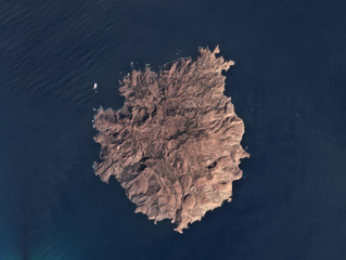 The roughly 9-km-wide Brava Island has numerous domes, coulées, craters, and cones across the island surface, shown in this February 2019 Planet Labs satellite image monthly mosaic (N is at the top). From the SE side towards the center are several domes, including Morro da Pedras and Morro Largo. In the center is the Fundo Grande, Cova Lima Doce, and Cova Joana craters as well as the Munhoto fault zone. Many of the more recent craters formed during phreatomagmatic eruptions.
Satellite image courtesy of Planet Labs Inc., 2019 (https://www.planet.com/).
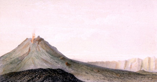 The steep-sided Pico stratovolcano is the most prominent feature within a large 9-km-wide caldera that is breached to the east. Cha caldera, whose rim appears at the right, is located asymmetrically NE of the center of the Cape Verde island of Fogo. Pico is capped by a 500-m-wide, 150-m-deep summit crater. Pico was apparently in almost continuous activity from the time of Portuguese settlement in 1500 CE until around 1760. Later historical lava flows, some from vents on the caldera floor, reached the eastern coast.
 From the collection of Maurice and Katia Krafft.
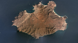 The 25-km-wide Pliocene-Pleistocene São Vicente is shown in this February 2019 Planet Labs satellite image monthly mosaic (N is at the top). The products of the most recent volcanism are at the two NE peninsulas (northern Baia das Gatas and eastern Calhau) and the far-eastern area. The two small cones near the eastern coastline are Vulcãno Viana (right) and Curral de João Paula (left). The linear ridge in the NE area is Monte Verde.
Satellite image courtesy of Planet Labs Inc., 2019 (https://www.planet.com/).
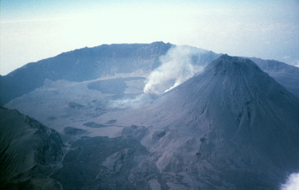
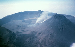 The 9-km-wide Cha caldera, open to the east, truncates the summit of Fogo stratovolcano. An ash plume (center) rises from an active vent on the western flank of the steep-sided Pico central cone (right). Pico is more than 1 km high and capped by an approximately 500-m-wide, 100-m-deep summit crater. Numerous historical eruptions have occurred from the summit of Pico and from its flanks in Cha caldera.
Photo by Dick Moore, 1995 (U.S. Geological Survey).
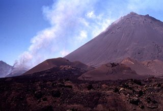 A steep-sided central cone, Pico do Fogo, rises more than 1 km above the floor of the Cha caldera. The island of Fogo is a massive stratovolcano, truncated by a 9-km-wide caldera that is breached to the east. Pico was apparently in almost continuous activity from the time of Portuguese settlement in 1500 CE until around 1760 CE. It is seen here in 1995 during an explosive and effusive eruption from a vent on its lower western flank (left). A plume of ash and steam is visible from the vent. Fogo erupted again in 2014-2015, when lava flows destroyed the intra-caldera villages of Portela and Bangaeira.
Photo by Nicolau Wallenstein, 1995 (Center of Volcanology, Azores University).
This is a compilation of Cabo Verde volcano information sources, such as official monitoring or other government agencies.
| Volcanic Ash Advisory Center | |
|---|---|
| Toulouse Volcanic Ash Advisory Center (VAAC) Notices and Archive | |